Formula One returns. This year’s cars are different. Sleeker. Faster.
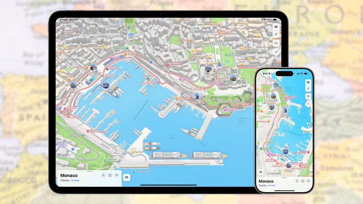
You can spot them where you wouldn’t expect. Not just on the TV screen, but inside your pocket. Apple Maps brought back the Detailed City Experience for Monte Carlo this weekend, June 5 to June 7. It shows the actual race course, turn markers, the pits, grandstands, and the finish line.
Built specifically for the 2025 event, the look shifted slightly. The track used to be a bright red line, now it is dark gray. It blends in better. The digital cars parked along the route wear this year’s team livery. Don’t wait for a simulation. Their positions are static, purely decorative visual flair.
But the surrounding landmarks got a real upgrade. 3D models of the Casino de Monte-Carlo and the Hôtel de Paris look sharp. There are day versions and night versions. You can flip between them. It feels like the city, not a game.
Monaco was the first Circuit Apple built this detailed overlay for. They learned from it. Since then, they rolled out similar maps for Las Vegas, Melbourne, Montreal, and Miami. These activate only during race weeks. Apple TV now holds US broadcasting rights for the series. The investment is heavy, and it shows in the software.
Detailed maps turn navigation into part of the spectator experience.
Beyond the race track, the map includes the usual clutter of a modern city. Bike lanes, road markings, street furniture. If you are actually down on the Côte d’Azur, this isn’t just trivia. It tells you where the toilets are. Where the footbridges are. Where the roads close.
It works for everyone, whether they hold a ticket or just scroll on their phone. Is it the best use of your screen time during a race weekend?
Maybe not. It is still there, though, waiting for the checkered flag to fall, while the rest of us navigate the closures.