Gaia GPS Cartes Topo Randonnée isn’t just another map app. It is a robust navigation engine built for people who spend their weekends off-grid. Whether you are hiking, trail running, mountain biking, or skiing, the app provides detailed topographic layers and trace tracking tools that work even when cell service vanishes. That last part matters. A lot.
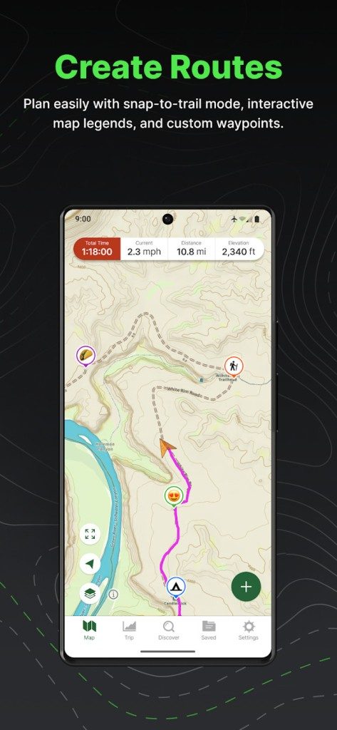
The interface is clean enough for beginners but packed with depth for veterans. It integrates layers from IGN, OpenStreetMap, and satellite imagery. You can plan routes, export GPX files, and sync data across devices. It runs on Android, iOS (including iPhone, iPad, and Apple Watch), and directly in your web browser. This multi-platform support means you are not locked into a specific ecosystem.
Where to Download and Device Compatibility
Getting started requires visiting the official app stores for your specific hardware. Android users head to Google Play. iOS users go to the App Store. Both are free to download. Apple Watch owners get a companion app for quick wrist-based navigation or real-time tracking.
If you prefer working from a desk, there is no native desktop client for Windows, macOS, or Linux. You use the web service instead. It works fine in any modern browser. No installation needed. Just log in and start planning.
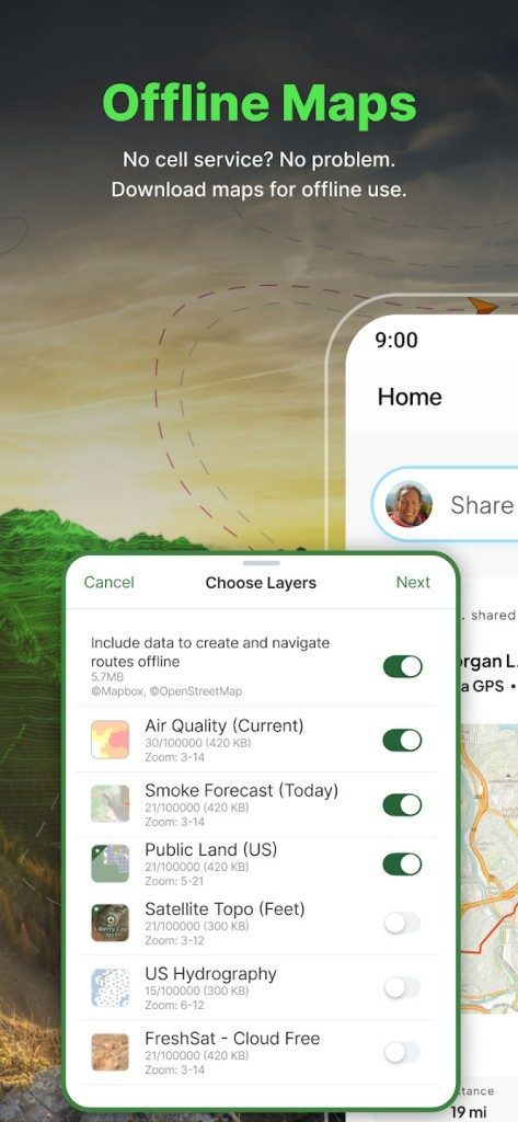
Once installed, the setup is straightforward. Create an account. Set your hiking preferences. Download the specific map tiles you need for your destination. This offline caching is critical. It saves storage space by letting you preview and select only the zones you will actually use. You can then take those maps offline. No internet required.
Data Exchange and GPX Management
A frequent question among users involves compatibility with other GPS hardware or outdoor platforms. Gaia GPS handles this well through GPX import and export functions. You can move tracks between the app, third-party software, and dedicated sports GPS units. This creates a flexible workflow.
It also supports archive creation and post-hike analysis. You can review your performance data long after the boots are off. This level of control makes it a standard tool for serious outdoor enthusiasts who refuse to rely on a single platform or connection.
Why Offline Maps Are Non-Negotiable
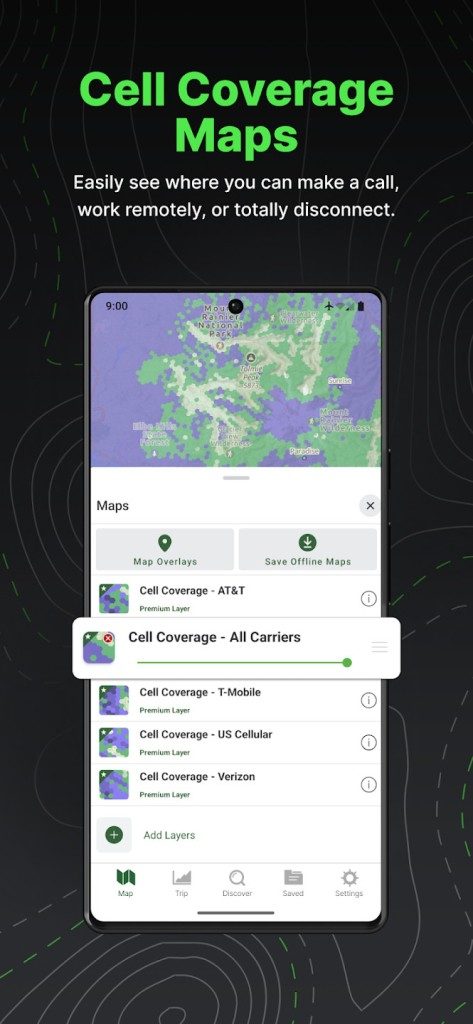
The real value here is connectivity independence. Cell towers do not reach every trailhead. They certainly do not cover deep mountain ridges or remote desert canyons. Relying on live data in these zones is a risk. Downloading maps beforehand eliminates that variable.
The app’s ability to synchronize across devices means you can plan on a laptop, refine on an iPad, and navigate on a phone or watch. The data stays consistent. The traces match. The route remains intact.
The Cost of Convenience
While the base app is free, advanced features often require a subscription. The free version covers basic navigation and essential map layers. Paid tiers unlock detailed topographic data, additional satellite imagery, and enhanced trace tools. For casual day hikers, the free tier might suffice. For multi-day expeditions or complex route planning, the premium features justify the cost.
The interface remains intuitive regardless of the tier. Layer toggling is simple. Search functions are responsive. The learning curve is shallow. You spend less time figuring out the software and more time on the trail.
Final Thoughts
Gaia GPS Cartes Topo Randonnée fills a specific gap. It bridges the gap between basic compass navigation and overly complex GIS software. It is not perfect. The web version lacks some offline capabilities of the native apps. The free tier is somewhat limited. But for most outdoor activities, it provides reliable coverage.
It works. It syncs. It saves your location. That is usually all you need when you are three miles from the nearest paved road. The rest is up to your feet.

You don’t need a subscription to get value. The free tier of Gaia GPS actually holds up surprisingly well against paid competitors. It gives you core mapping tools, route planning with relief visualization, and real-time GPS tracking. Most hikers can survive on this alone. But if you push into deep backcountry or need specific data layers, the premium tier becomes less of a luxury and more of a necessity.
Mapping layers and offline access
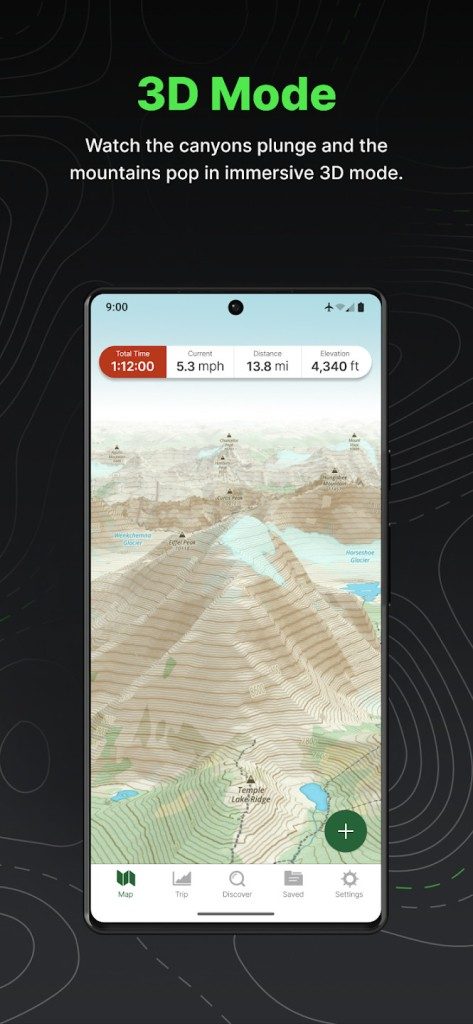
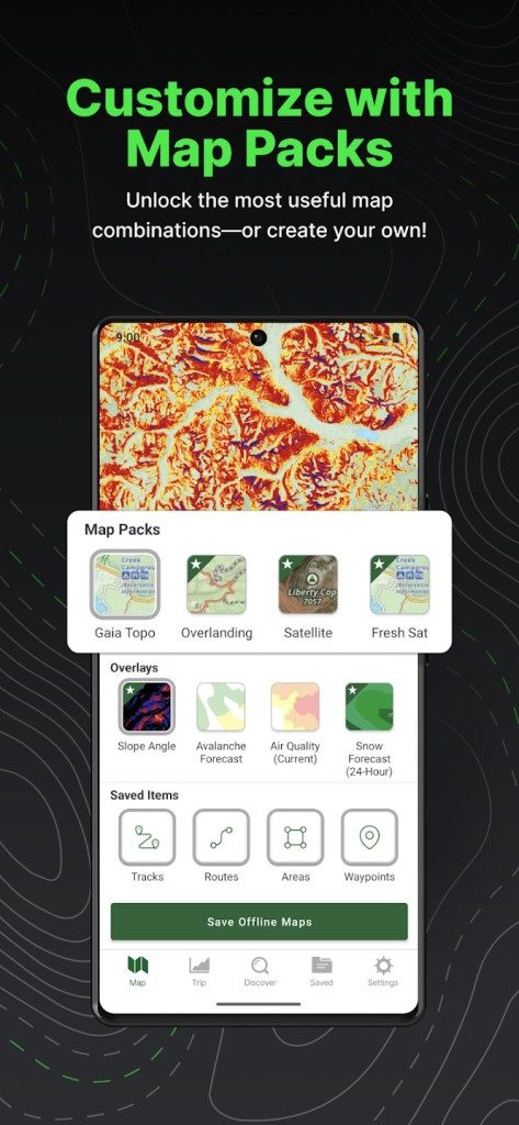
The real differentiator here is the library. Gaia GPS offers specialized overlays. You get forest maps, MTB trails, ski zones, and hydrological charts. These aren’t just skins. They are functional data layers that change how you see the terrain.
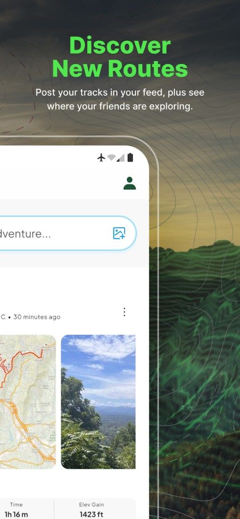
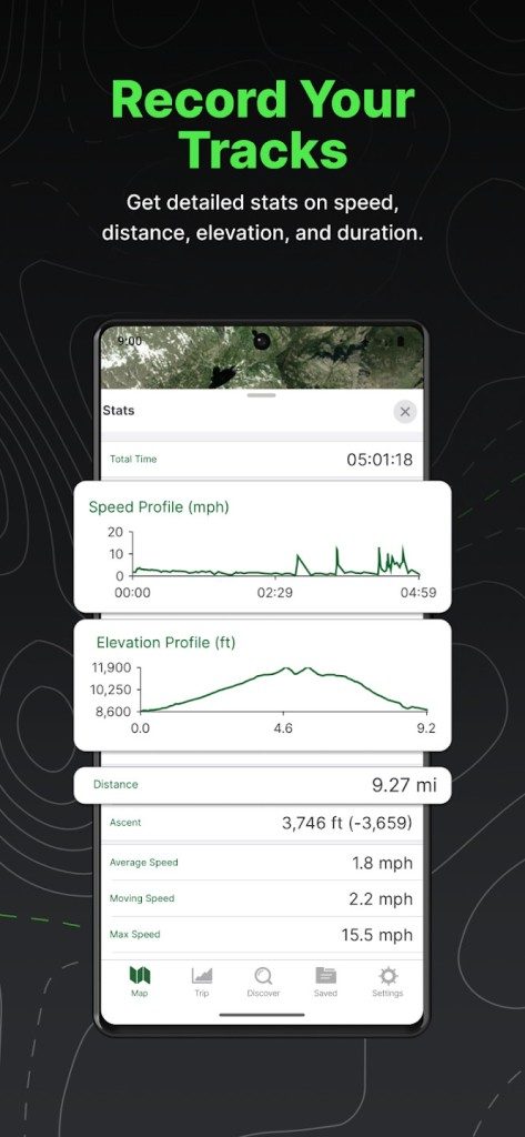
Other apps like komoot or ViewRanger lean into community. They focus on photo sharing and social features. Gaia stays technical. It’s analytical. You get distance, elevation gain, average speed, and max speed recorded instantly. Or you can check the data later. The GPS trace is accurate and detailed.
Offline mode is where the paid wall stands firm. Free users get a flexible management of base maps. That’s it. Premium subscribers unlock unlimited downloads for offline use. You also get high-resolution aerial imagery. And integrated weather forecasts. For anyone heading off-grid, unlimited offline maps are a safety net. Relying on cellular data in the mountains is a gamble.
Version updates and performance
Keeping the app current is straightforward. You check the app store. If an update is available, you install it. Automatic updates ensure you have the latest bug fixes and feature additions. You don’t need to manually hunt for patches.
Can you roll back? Not easily. Downloading older versions is restricted. It depends on the platform policy. Usually, the store won’t let you install a legacy build once a newer one is live. Is that a problem? Generally, no. The latest version offers the best performance and security. Staying outdated just introduces vulnerabilities and missing features.
Pricing structures and support options
The free download works on its own. But the premium subscription changes the game. You can pay monthly or annually. The price varies by region and platform. It’s competitive compared to direct rivals in the outdoor software space.
There’s no student discount currently. No special deals for hiking associations either. Sometimes partnerships happen, but you can’t count on them. If you’re a solo hiker or a serious professional, the annual sub usually makes the most financial sense.
Support is decent. The official site hosts detailed tutorials. There’s a user guide. A FAQ section that actually gets updated. This helps you navigate the complexity. You can go from basic route planning to post-expedition data analysis.
For deeper technical issues, there’s a reactive support system. You submit a request. You talk to the dev team. It’s not always instant, but it exists.
Learning the tools
If you want to master the app, you can look beyond the help docs. Video training exists. These courses range from beginner to advanced. They are sometimes run by institutional partners. Or outdoor ambassadors.
The goal is optimization. You learn to configure the app for your specific needs. You understand the advanced cartography. You prepare better for weather, terrain, and difficulty. It’s not just about pointing a compass. It’s about reading the landscape through data.
Downloading Gaia GPS Cartes Topo Randonnée is a solid move for adventurers who want reliability. The features are rich. The ergonomics handle multiple use cases. It’s a resource for exploring nature safely. With its regular updates and modularity, it offers a lot of freedom.
You still have to decide if the extra layers justify the cost. For casual day hikes, probably not. For multi-day treks in unknown territory, the distinction between a map and a navigation system becomes critical. The app gives you the tools. You have to know how to wield them.
You do not need a high-end smartphone to run Gaia GPS Cartes Topo Randonnée. You just need a working GPS chip and a bit of planning. This app strips away the corporate bloat of standard mapping tools. It focuses on raw utility for hikers, cyclists, and backcountry users who refuse to rely on cell towers.
The technical foundation is straightforward. The app leverages your device’s built-in sensors. GPS for location. Barometric altimeter if your phone or watch has one. Digital compass for direction. This hardware integration allows for precise tracking even when you are miles from civilization. But it requires preparation.
Platform Support and Offline Requirements
Gaia GPS Cartes Topo Randonnée runs on Android and iOS. It supports iPhones, iPads, and Apple Watches. There is also a browser-based version for desktop use. This multi-platform approach matters for route planning. You can map a trail on your laptop at home. Then sync it to your phone for the actual hike.
The offline functionality is the key feature. Navigation does not require an active internet connection. This is critical. Signal drops in canyons or high ridges are common. The app works by downloading map layers before you leave. These layers include topographic maps, OpenStreetMap data, satellite imagery, and specialized layers. Availability varies by region and provider. You must download the specific area you intend to visit.
Internet is only needed for account creation, syncing across devices, and initial map downloads. Once the data is on the device, you are on your own. And that is a good thing. No buffering. No lag. Just coordinates and contour lines.
Data Formats and Interoperability
Sharing your route is easy. The app supports GPX file import and export. This is the standard format for GPS data. You can also use KML and KMZ files depending on the platform. This interoperability allows you to use Gaia with other outdoor tools. Import a track from a friend. Export your own to share with a club.
Synchronization happens via the cloud. Your routes and favorites move between your mobile device and the web service. This keeps your data safe. If you lose your phone, your planned trails are still accessible online. It is not just about navigation. It is about data retention.
Sensors and Privacy Controls
The app uses your device’s GPS/GNSS for positioning. If your hardware supports it, the barometric altimeter provides elevation data. This is more accurate than GPS-derived altitude. The digital compass aids in orientation.
Privacy is managed through account settings. You control location data sharing. This is important for safety-conscious users who want to track their position without broadcasting it publicly. The interface is primarily in English. However, topographic names are multilingual based on the map source. This helps when navigating internationally or in regions with mixed naming conventions.
Who Needs This Tech Stack?
The target audience is specific. Hikers. Trail runners. MTB riders. Cross-country skiers. Anyone using the outdoors for recreation or work. The app is free with paid options. This freemium model keeps the barrier to entry low. You can test the core navigation features without paying.
Help and support are available online. There are tutorials and guides. The technical specs ensure durability. The app evolves without forcing version updates that break compatibility. It is built for long-term use in rugged environments.
If you are planning a multi-day trek, download the maps beforehand. Test the offline mode. Check your battery life. The tech is ready. The terrain is not.
The hidden cost of “free” software
You didn’t pay for the app. You are the product.
This isn’t a conspiracy theory. It’s basic economics. When a service is free, data collection becomes the revenue model. Companies track your clicks. They map your location history. They analyze your purchase patterns to build a profile. This profile is then sold to advertisers or used to train AI models.
For the average user, this feels invisible until it isn’t.
A sudden surge in targeted ads for a topic you only searched once. A recommended video that feels eerily specific. It’s creepy because it is. The convenience of free tools comes with a tax on your privacy.
How to reclaim your digital boundaries
You don’t need to become a tech wizard to stop being tracked. Simple steps work.
First, audit your permissions. Why does a flashlight app need access to your contacts? Deny it. Most smartphones offer a “while using” option. Take it.
Second, use privacy-focused browsers. Standard browsers are data harvesting engines. Switch to one that blocks trackers by default. It’s a small change with a massive impact on your daily anonymity.
Third, turn off personalized ads. Both Apple and Android have this setting buried in privacy menus. Toggle it. You’ll still see ads. They just won’t know who you are.
Why open source matters more now
Proprietary software is a black box. You don’t know what’s inside. Open source code is visible. Anyone can inspect it.
This transparency builds trust. If a bug is found, the community fixes it. If a security flaw is discovered, it’s patched quickly. Closed systems rely on the vendor’s promise that everything is fine. Open source relies on verification.
For businesses, this reduces risk. For individuals, it reduces dependency. You own the code if you run it locally. You aren’t at the mercy of a server outage or a sudden subscription hike.
The shift toward local-first computing
Cloud storage is convenient. But it’s fragile. Your data lives on someone else’s hard drive.
Local-first software writes directly to your device. It uses your storage. It works offline. If the internet goes down, you still have your files.
This isn’t just about backup. It’s about control. When your documents are local, you control the encryption. You control who sees them. The cloud becomes a sync tool, not a vault.
What’s next for user control
Regulators are catching up. GDPR in Europe and CCPA in California are forcing changes. But laws move slowly. Technology moves fast.
The trend is clear. Users want options. They want to know what’s happening with their data. They want to say no.
Software companies that ignore this will lose trust. It’s not just about features anymore. It’s about ethics. The market is shifting toward transparency.
You have the power to choose. Every app you install is a vote. Every permission you grant is a line in the sand.
The question isn’t whether you can stop the tracking. It’s whether you care enough to try.